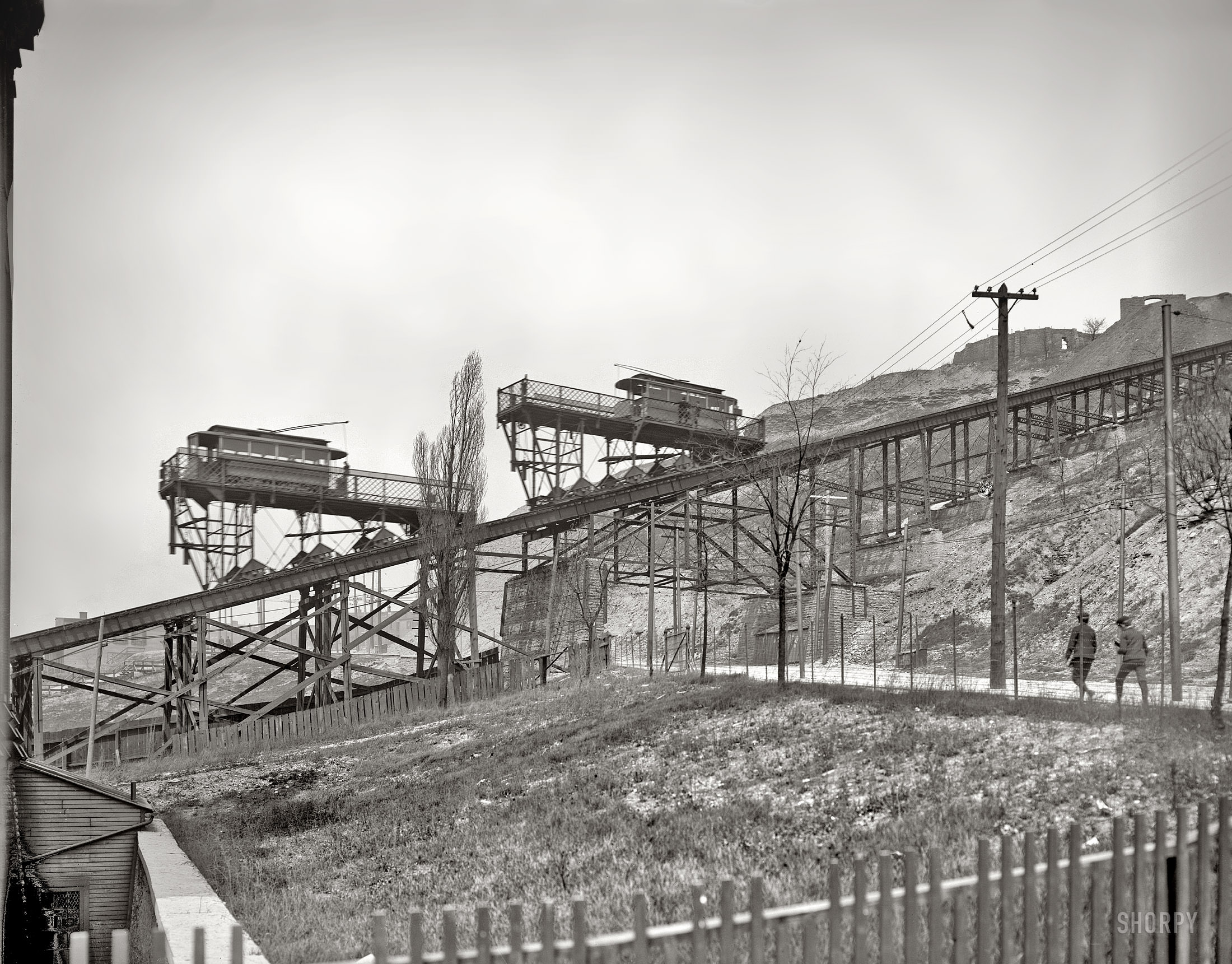
Rising sharply up a Cincinnati hillside in 1904, the inclined plane dominates the landscape like an iron staircase, its trestles and cross-bracing laid bare against a pale sky. Two small cars sit on the grade, their canopies and railings hinting at a ride engineered for both necessity and reassurance, while the long track stitches together low ground and high ground in one confident line. Telephone poles and taut wires run alongside, underscoring how closely transportation and communication were entwined in an era of rapid urban change.
Below the structure, rough fencing and open ground suggest a city edge still in the process of being shaped, where paths, lots, and slopes hadn’t yet been smoothed into the familiar grid. A few pedestrians on the right appear to be making their way along the roadside, dwarfed by the scale of the machinery overhead and the cut of the hill behind it. The scene feels practical rather than grand: a working solution to steep terrain, built to carry everyday people between neighborhoods separated by elevation.
For anyone exploring Cincinnati history, early 20th-century transit, or the story of hillside engineering, this photograph offers a crisp look at how cities adapted to geography before automobiles ruled every commute. The inclined plane stands as a reminder that public transportation once had to conquer topography directly, not simply pave over it. As a piece of places-and-people Americana, it captures both the ingenuity of infrastructure and the quiet human presence that gave it purpose.