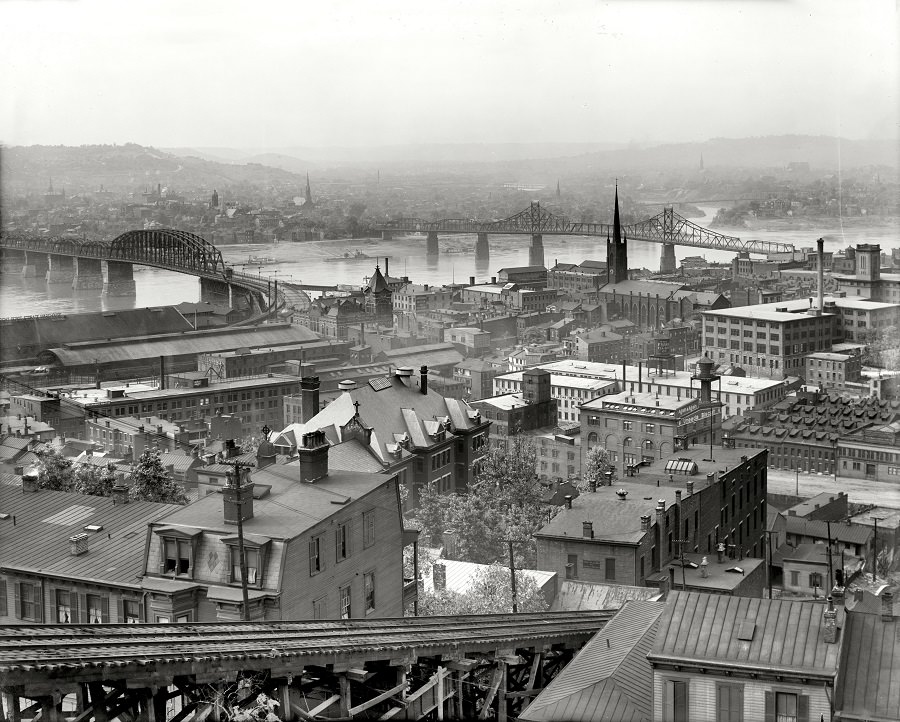
From the hillside of Mount Adams, Cincinnati opens out in layers—tight rows of rooftops in the foreground, a dense downtown grid beyond, and the Ohio River threading the whole scene together. Church spires punctuate the skyline, while brick and stone blocks cluster along straight streets that hint at the city’s rapid growth around the turn of the twentieth century. The elevated vantage point invites you to read the city like a map, tracing neighborhoods, commercial corridors, and the busy waterfront below.
Bridges dominate the middle distance, their steel trusses and arches spanning the river as symbols of connection and modern engineering in circa 1909 Cincinnati. Rail lines and industrial roofs near the water suggest the movement of goods and people, when river traffic and the railroad shaped daily life and regional commerce. Even in a still photograph, the composition feels busy—an urban landscape built on transportation, industry, and ambitious architecture.
Haze softens the far hills and pushes the city into a gentle gradient, giving this historic view a sense of scale that modern street-level photos rarely capture. For anyone searching Cincinnati history, Mount Adams views, or early 1900s cityscapes, this image offers a richly detailed snapshot of how the Queen City looked as it expanded along the Ohio River. It’s a reminder that today’s skyline rests on a layered past, built one roofline, steeple, and bridge span at a time.