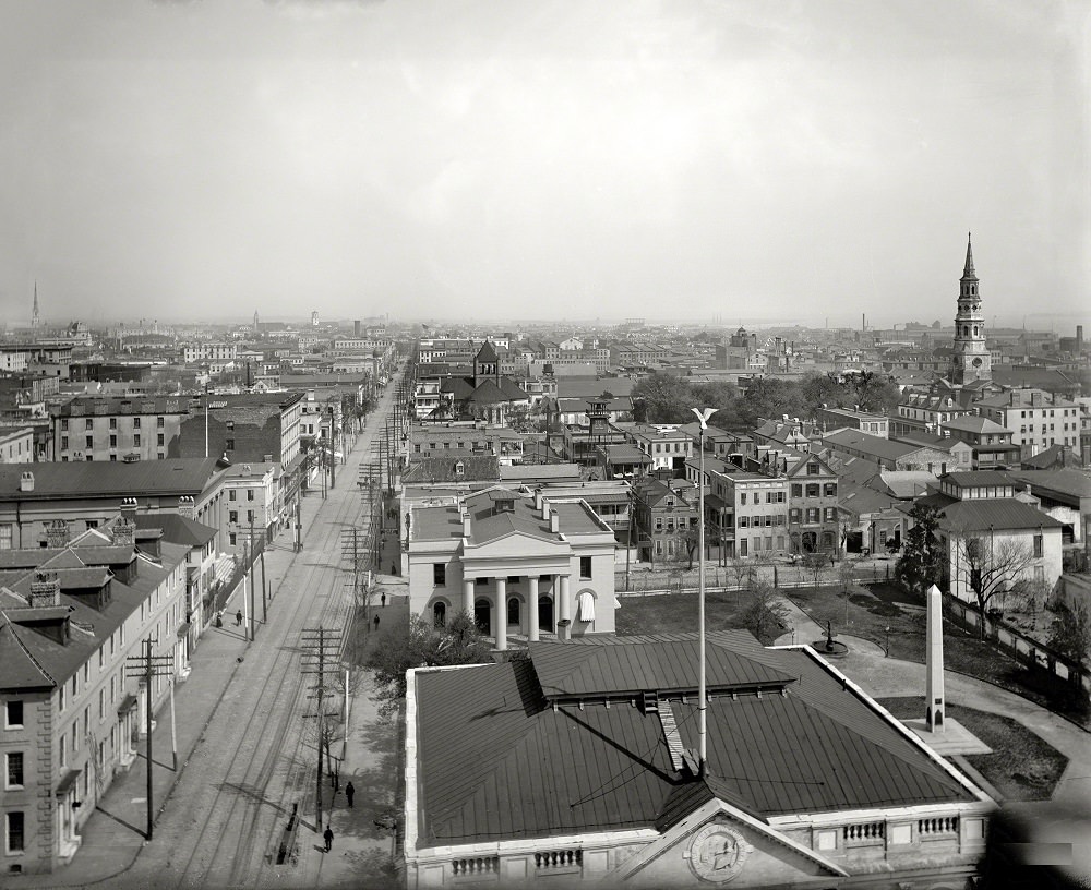
From the lofty vantage of St. Michael’s Church, Charleston, South Carolina stretches outward in a broad, orderly grid, its rooftops and steeples stacked like a quiet tide against a pale sky. A long, straight street runs from the foreground deep into the distance, lined with telegraph poles and the faint parallel lines of streetcar tracks—small details that speak to a city balancing old-world architecture with modern infrastructure at the turn of the century. The scene feels expansive yet intimate, inviting the eye to wander from block to block and imagine the daily routines unfolding below.
Near the center, a classical, columned building anchors the view, while to the right a tall church spire punctuates the skyline and reminds us how prominent sacred spaces were in Charleston’s civic landscape. Beyond these landmarks, rows of houses, commercial blocks, and clustered chimneys create a dense urban texture, suggesting neighborhoods where commerce, worship, and home life lived side by side. The sparse figures visible on the street hint at movement and purpose without overwhelming the calm, architectural focus of the photograph.
For readers drawn to historic Charleston images, this 1900 panorama offers more than a postcard pretty skyline; it provides a structured glimpse into how the city looked and functioned at street level. The interplay of transit lines, utility poles, and tightly packed buildings makes it a valuable reference for anyone interested in Charleston’s urban history, architecture, and the evolution of its streetscapes. Even without naming every corner, the elevated perspective from St. Michael’s Church situates the viewer inside the city’s rhythm, where time feels both distant and remarkably close.