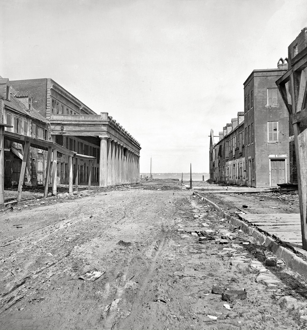
Looking east from near the corner of East Bay Street, Vendue Range stretches ahead as a broad, scraped roadway framed by worn brick and timber. The long colonnaded market building on the left anchors the view with its repeating pillars and deep shadowed bays, while the right side is lined with sturdy warehouses whose shutters and doors hint at commerce paused. Far beyond the street’s end, the bright band of water pulls the eye toward Charleston’s waterfront and the traffic of the harbor that once defined this district.
Rubble, broken paving, and scattered boards speak quietly of disruption, leaving the scene more like an aftermath than a bustling thoroughfare. Temporary-looking wooden supports and ragged edges along the storefronts suggest repairs underway or structures hastily propped, a common sight in cities adjusting to sudden change. Even without crowds, the photograph is alive with texture—rutted earth, uneven cobbles, and the geometry of masonry—making it a compelling document of Charleston street life in 1865.
Vendue Range has long been associated with markets and exchange, and this view captures the architecture that made that activity possible: sheltered arcades, wide frontages, and access to East Bay’s maritime corridor. For readers interested in Charleston history, Civil War–era streetscapes, or the evolution of the city’s waterfront, the image offers a clear, ground-level perspective that complements maps and written accounts. It invites a slower reading of the built environment, where every column and threshold hints at the routines—and the upheavals—experienced by the people who moved through these spaces.