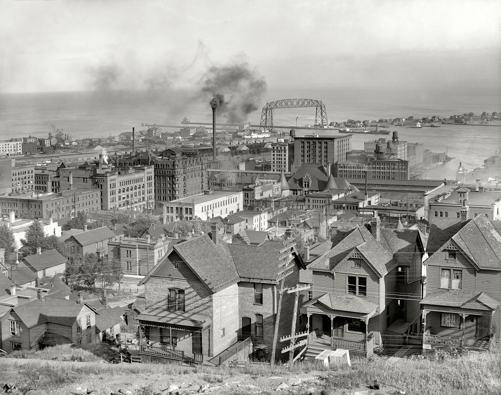
From the vantage of Duluth’s Incline Railway in 1910, the city spreads out in tiers—wooden hillside homes in the foreground giving way to a dense downtown of brick blocks, warehouses, and tall commercial buildings. The steep grade is easy to feel even in a still image, with rooftops stepping downward toward the waterfront and the working city packed tightly between hill and harbor.
Industry announces itself across the middle distance: smokestacks trail dark plumes, and the broad outline of a lift bridge rises near the harbor entrance, hinting at constant movement between Lake Superior and the streets behind it. Rail yards, docks, and utilitarian rooftops knit the shoreline together, while the water beyond provides a calm horizon that contrasts with the bustle of an early 20th-century port.
Looking closely, the photograph becomes a story of places and people even without faces—porches, fenced yards, and narrow lanes suggest everyday routines unfolding above a booming commercial district. As a historical Duluth photo, it’s also an absorbing record of urban growth: residential neighborhoods perched on the hill, civic and business architecture clustering below, and the infrastructure of shipping and rail defining the city’s relationship with the lake.