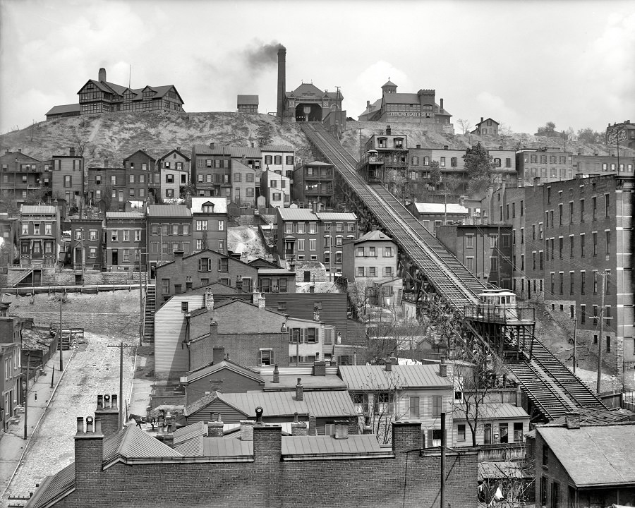
Rising sharply through a dense patchwork of rooftops, the Mount Adams Incline dominates this Cincinnati hillside scene circa 1908, its twin tracks cutting a straight, confident line from the basin up to the neighborhood above. The lower platform and car sit at the foot of the grade, while the upper station crowns the crest, framed by larger buildings and the smoky silhouette of an industrial stack. Even without motion, the geometry of rails, trestles, and stair-stepped streets hints at the daily rhythm of commuters and visitors making the climb.
Down below, closely spaced houses and small apartment blocks press together in layers, their porches, windows, and chimneys forming a textured portrait of early 20th-century urban life. The steep terrain shapes everything—streets bend, retaining walls hold the slope, and buildings cling to whatever flat ground can be claimed. This is “Places & People” in architectural form: a neighborhood built around elevation, proximity, and the need to connect hilltop and river city.
As a piece of Cincinnati history, the Mount Adams Incline represents more than a transit novelty; it reflects how cities engineered solutions to geography before automobiles remade everyday travel. The image rewards a slow look, from the busy residential blocks to the commanding upper station, offering a vivid sense of scale and ambition. For anyone searching Mount Adams Incline photos, vintage Cincinnati transportation, or hillside neighborhoods around 1908, this view captures the moment when rails stitched the city together.