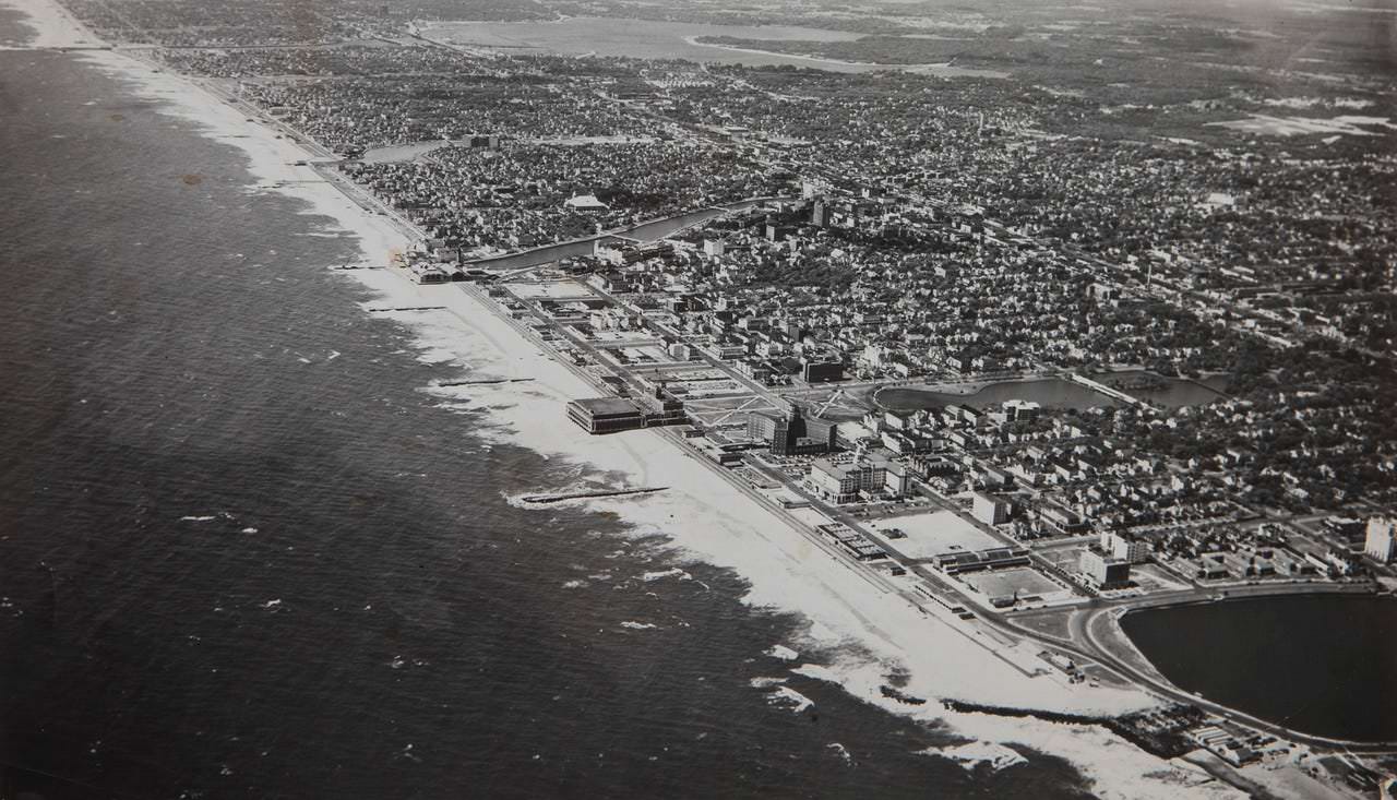
This 1954 aerial photograph of Asbury Park captures a sweeping mid-century view of the New Jersey shoreline, with the Atlantic Ocean stretching along the left and the city’s beachfront district running in a long, bright ribbon of sand. From above, the coastline’s curves, surf lines, and boardwalk-era development create a striking contrast between open water and tightly packed urban blocks.
The image reveals the dense grid of streets and neighborhoods extending inland, punctuated by larger buildings near the waterfront and clusters of structures that suggest hotels, entertainment, and commercial activity. Lagoons and waterways are also visible beyond the main beach area, adding another layer to the coastal landscape and showing how the city meets the back-bay environment.
Ideal for local history enthusiasts and vintage photography collectors, this historic Asbury Park aerial photo offers a detailed snapshot of the community’s mid-20th-century layout and seaside character. It’s a compelling piece of Asbury Park history that highlights coastal development, architecture, and the enduring appeal of a classic Jersey Shore resort town.