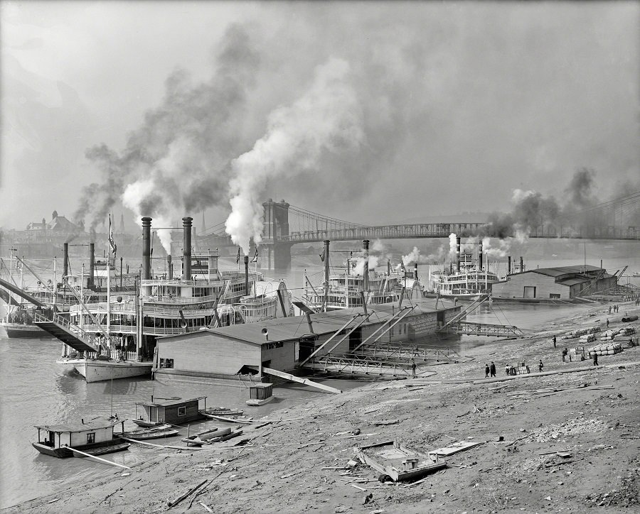
Smoke stacks rise in thick plumes above a busy stretch of the Ohio River, where multiple steamboats crowd the shoreline and tie up beside long, low riverfront buildings. The scene feels industrial and energetic: boilers working, decks layered with railings and rigging, and a working waterfront arranged for constant loading and unloading. In the distance, a large suspension bridge spans the water, anchoring the river’s role as a corridor between towns and trade.
Along the sloped bank, scattered timbers and small craft hint at the everyday mechanics of river life—repairs, ferrying, and the endless handling of goods that kept communities supplied. Tiny figures on the shore give scale to the vessels and the wide, open river, suggesting a place where labor and travel overlapped from dawn to dusk. Even without captions for individual boats or buildings, the composition reads clearly as a hub of commerce rather than a quiet scenic overlook.
Taken circa 1907, this historical Ohio River photo offers a vivid glimpse into an era when steamboat traffic and riverfront infrastructure shaped local economies across the region. It’s a useful window for anyone researching American river transportation, early 20th-century industry, or the changing landscape of waterfront towns. The bridge, the clustered steamers, and the working shore together tell a story of movement—people and products flowing through a river that functioned as a main street for generations.