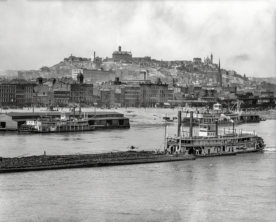
From the Covington shoreline, the Ohio River opens into a busy working corridor, with low barges and stout riverboats cutting across the foreground while Cincinnati rises in layers beyond. The water’s surface carries the weight of commerce, and the clustered waterfront buildings—warehouses, workshops, and river landings—form a dense band between river and hill. Above it all, Mount Adams stands as a natural lookout, its slopes packed with houses and civic structures that step upward toward the skyline.
What makes this 1905 view so compelling is the way it balances “Places & People” without needing posed faces: human activity is everywhere in the smokestacks, docks, and vessels built for hauling goods and passengers. The steamboats’ tall stacks and decklines hint at the era’s river travel, when schedules, shipments, and weather all shaped daily life along the Ohio. Across the river, church spires and rooftops punctuate the hillside, giving the scene a recognizable Cincinnati character anchored by Mount Adams.
For anyone researching early 20th-century Cincinnati history, Covington riverfront life, or the evolution of the Ohio River waterfront, this photograph offers rich visual evidence of an urban landscape in motion. It captures the relationship between the industrial river edge and the residential heights above—an arrangement that defined how the city looked, sounded, and moved at the time. Seen today, the panorama reads like a map of ambitions, where boats, brickwork, and hillside neighborhoods meet at the waterline.