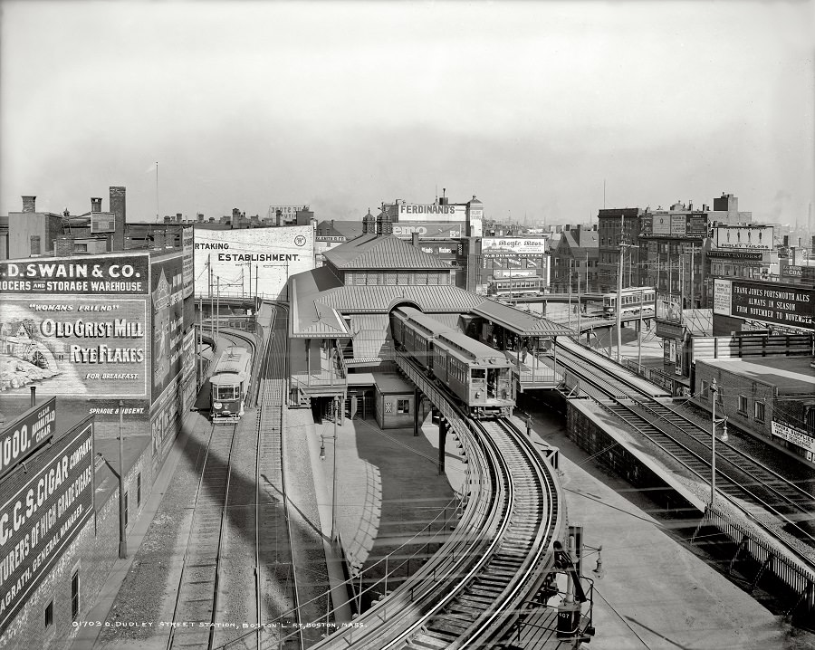
Rising above the surrounding rooftops, Dudley Street Station in Boston appears as a busy node of early-20th-century transit, its elevated tracks curving into a compact, multi-level terminal. A streetcar waits below while another car glides along the raised structure, turning the scene into a layered portrait of movement and infrastructure. The station’s canopies, platforms, and steelwork hint at the engineering confidence of the era, when rapid transit was reshaping daily life.
Billboards and painted advertisements crowd the edges of the view, turning nearby buildings into a public marketplace of words as much as goods. Large signs for groceries, cereals, and other wares compete for attention, reflecting a city where commerce and transportation grew side by side. That dense wall of lettering also helps date the atmosphere—an age before digital screens, when the skyline itself carried the sales pitch.
From this vantage point, the 1904 streetscape reads like a story about “Places & People” even when individuals are small: workers, riders, and passersby moving through a neighborhood organized around rails and schedules. The mix of street-level lines and elevated routes suggests how Boston’s transit network stitched together different districts and routines. For anyone searching Dudley Street Station Boston 1904 or exploring historic Boston transportation, the photograph offers a vivid, streetwise glimpse of the city in motion.