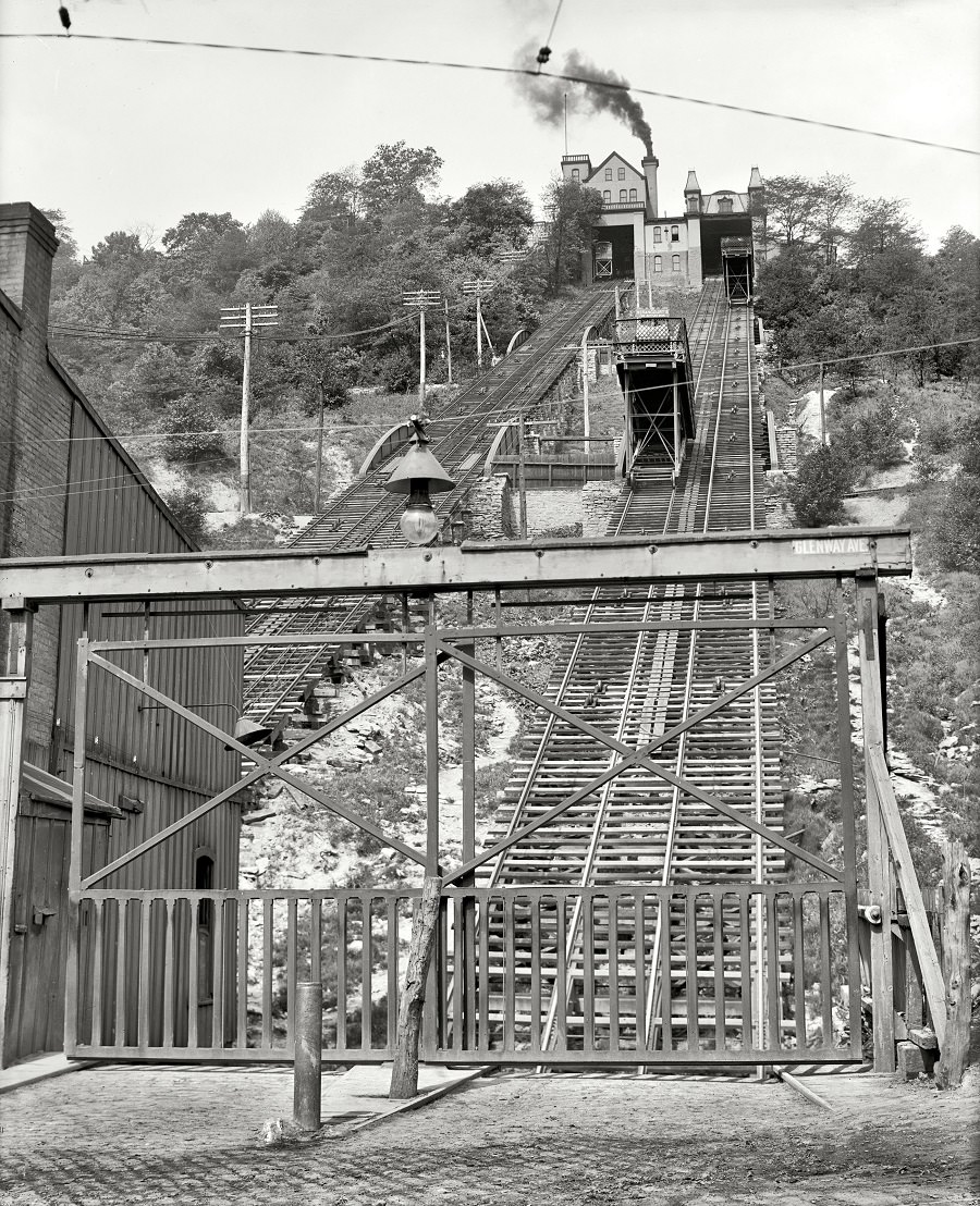
Rising sharply up the hillside, the Price Hill Incline reveals the engineering that helped Cincinnati knit together its lowlands and hilltop neighborhoods around the early 1900s. Twin lines of track climb toward a compact station structure at the summit, with cables and switchwork laid out like a mechanical ladder. Telegraph poles, overhead wires, and a stout timber gate at the base underline how carefully controlled and power-hungry this corridor of motion had to be.
The incline was more than a novelty ride; it served as a practical link in the Cincinnati streetcar and freight elevator system, moving people and goods over terrain that would otherwise slow a city’s daily rhythms. Smoke from a rooftop stack hints at the machinery working behind the scenes, while the steep grade and reinforced supports speak to the constant strain of hauling cars up and down the slope. Even without crowds in the frame, the scene carries the feel of an industrial commute route—part transit line, part vertical utility.
For readers exploring Cincinnati history, this circa 1906 view offers a window into how urban transportation adapted to topography before modern highways reshaped travel patterns. Details like the parallel tracks, cable pathways, and hillside cut make the photo a strong reference point for anyone researching the Price Hill Incline, historic streetcars, or early 20th-century freight handling in the city. It’s a reminder that infrastructure once had to climb—literally—to keep commerce and everyday life moving.