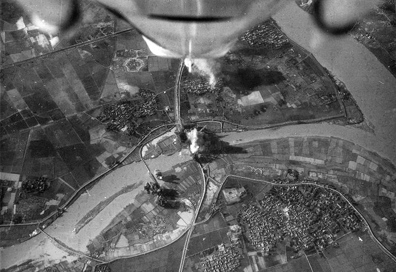
Seen from high above, a broad river bends through a patchwork of fields and clustered settlements, while sudden bursts of smoke rise from the ground like dark punctuation marks. The camera’s viewpoint—likely from an aircraft—turns the landscape into a map of vulnerable lines: roads, embankments, and bridges that could carry civilians one moment and military supply the next. In a single frame, the Vietnam War’s aerial dimension becomes painfully clear, where distant decisions translated into immediate destruction.
The contrast is what lingers: orderly farmland below, chaotic impact above, and a plume that suggests a strike landing near critical crossings. Photos like this help explain why the conflict between capitalism and communism was fought not only with infantry and ideology, but also through bombing campaigns aimed at movement, logistics, and control. Even without names or captions, the scene evokes the relentless pressure on waterways and transportation arteries that shaped daily survival and strategy across Vietnam.
As part of a collection of striking Vietnam War photos, this image invites readers to look past the abstraction of “targets” and see the human geography underneath—homes, harvests, and communities caught beside strategic routes. It’s a stark reminder that war photography doesn’t always need faces to convey loss; sometimes the wounded land tells the story. Explore the full gallery to trace how the conflict’s horror unfolded from the ground to the skies, and how its scars spread across places that once looked peaceful from above.