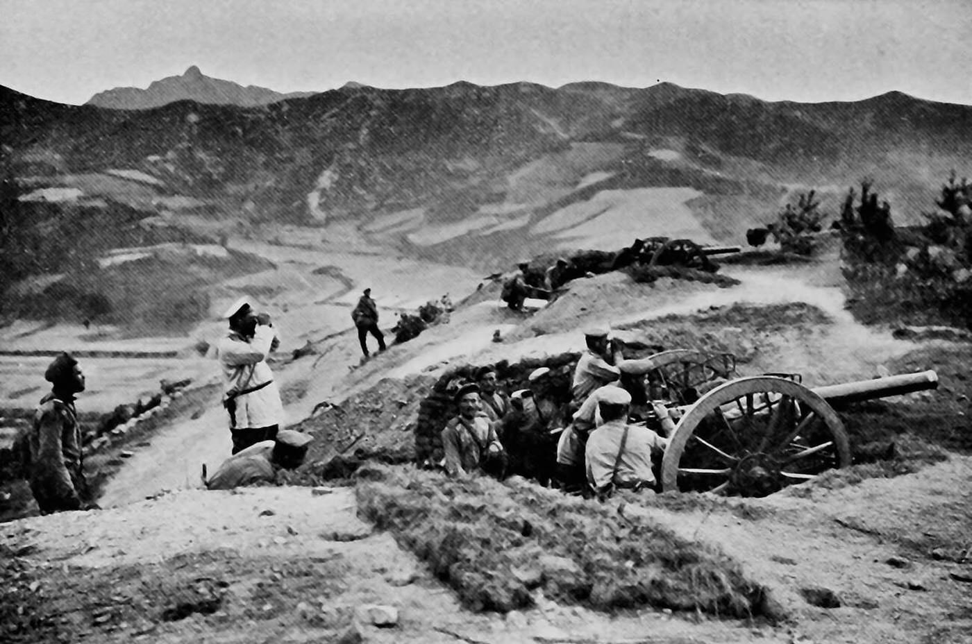
Along a wind-scoured ridge above the broad expanse of the Liao Plain, a Russian artillery position settles into the earthwork that keeps it alive. The gun’s long barrel projects over a rough parapet, its big spoked wheels half-swallowed by the dugout, while crewmen cluster low in the trench line. One figure stands upright with an optical instrument raised to his face, scanning the hazy distances where targets would have been judged and corrected.
The terrain tells as much of the Russo-Japanese War story as the soldiers do: open country below, broken by pale tracks and faint field patterns, and darker hills forming a hard horizon. Such heights were priceless, turning geography into advantage—visibility for observation, angles for indirect fire, and a commanding view that could stitch scattered units together through signals and ranging shots. Even in a still photograph, the posture of the men and the careful siting of the battery suggest a battlefield shaped by modern artillery and measured lines of sight.
Details like the improvised trenches, the compact working space around the breech, and the minimal cover on the slope evoke the daily routines of a frontline gun team—waiting, watching, and working under the threat of counter-battery fire. For readers exploring Wars & Military history, this scene offers a grounded look at how armies fought over Manchurian landscapes, where control of ridges and plains mattered as much as numbers. The image invites a closer reading of early twentieth-century warfare: not just dramatic charges, but patient positioning, logistics, and the relentless arithmetic of range and elevation.