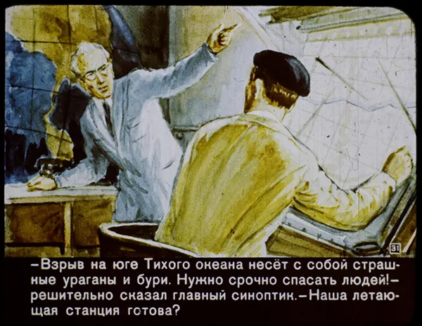
Urgency radiates from the scene: a stern, white-haired meteorologist leans forward from behind a desk, arm thrust upward as if punctuating every word. Across from him, a uniformed colleague sits with his back partly turned, focused on a large wall map threaded with lines that suggest storm tracks, routes, or an operational plan. The hand-colored, poster-like style gives the moment a dramatic clarity, blending scientific authority with the pressure of immediate decision-making.
In the lower band of the artwork, Cyrillic text reinforces the alarm described in the title, linking a South Pacific explosion to violent hurricanes and windstorms and calling for rapid rescue efforts. The composition places the map at the heart of the action, turning weather prediction into a command center narrative where information must be translated into movement. That tension—between analysis and action—makes the image feel like a snapshot from an era when meteorology, aviation, and civil defense were becoming tightly intertwined.
For readers drawn to historical aviation art, Cold War–era visual culture, or early disaster-response storytelling, this post offers a vivid example of how weather crises were dramatized for public attention. Search-friendly themes such as “meteorologist,” “storm map,” “hurricanes,” “rescue mission,” and “flying station” naturally attach to the scene without requiring specific names or dates. Whether viewed as propaganda, illustration, or imaginative reportage, the artwork invites a closer look at how catastrophe was narrated—and how preparedness was framed as a moral imperative.