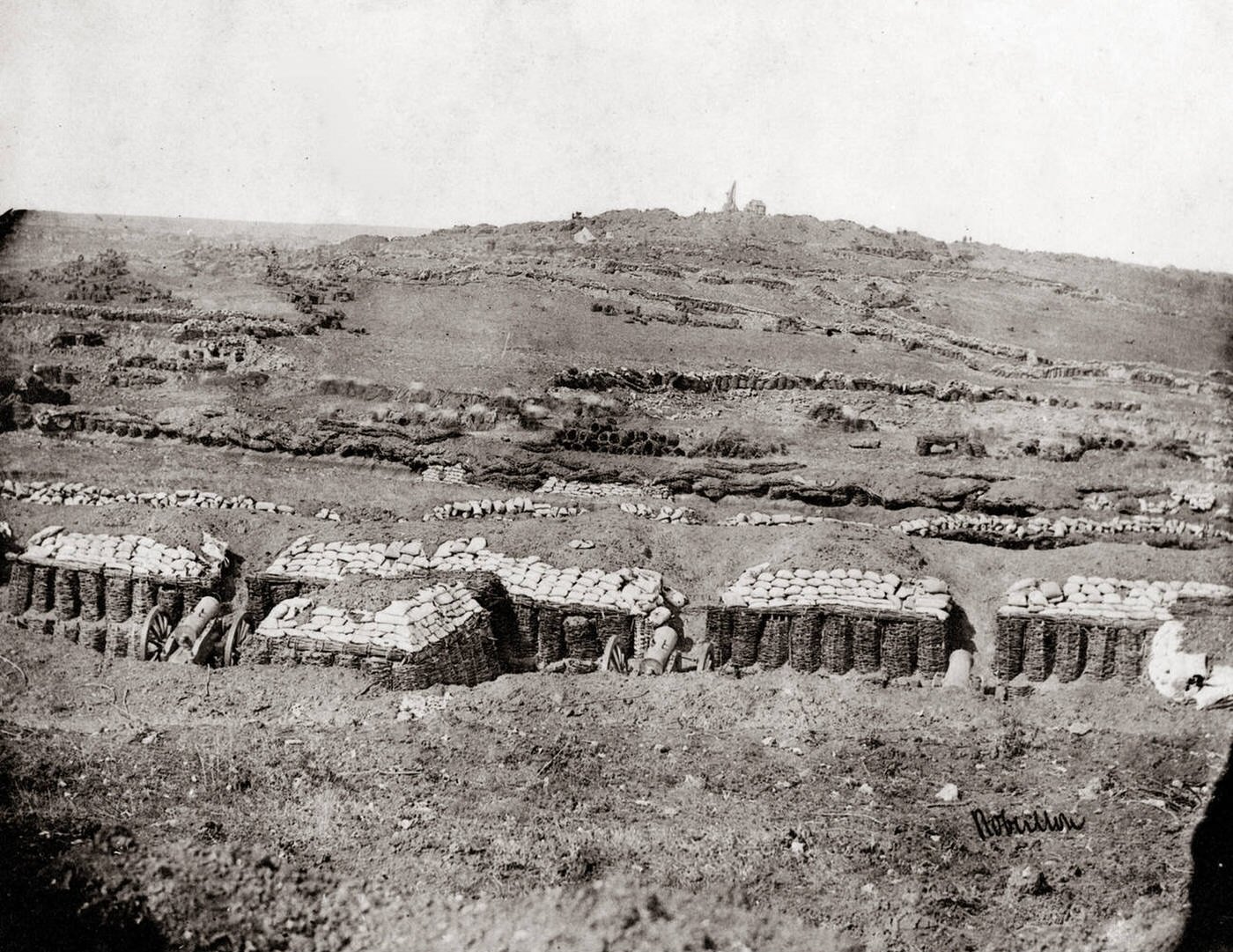
Across the bare slope, trench lines stitch the earth into a dense web of approaches leading toward the Malakoff during the Crimean War in September 1855. In the foreground, squat gun emplacements are reinforced with wickerwork revetments and capped with stacked sandbags, their artillery pieces angled out from the shelter. The scene reads as a landscape deliberately reshaped by siege warfare, where every ridge and dip becomes part of a calculated geometry of attack and defense.
Layer after layer of earthworks recedes into the distance, suggesting how engineers and soldiers inched forward under fire, extending parallels and communication trenches to close the gap. The hillside looks scraped and exhausted, with little vegetation left, a reminder that prolonged bombardment and constant digging could turn open ground into a scarred battlefield. Details like the low parapets and protective berms hint at the daily realities of survival—cover, concealment, and the relentless labor required to maintain them.
For readers exploring Crimean War history, this photograph offers a stark, documentary view of the siege methods that defined the struggle for key fortifications such as the Malakoff. It captures not heroics but infrastructure: fortification, artillery positioning, and the trench approaches that foreshadowed later industrial-era conflicts. As a piece of wars and military heritage, it invites close attention to the terrain itself—the silent witness to strategy, hardship, and the costly push of September 1855.