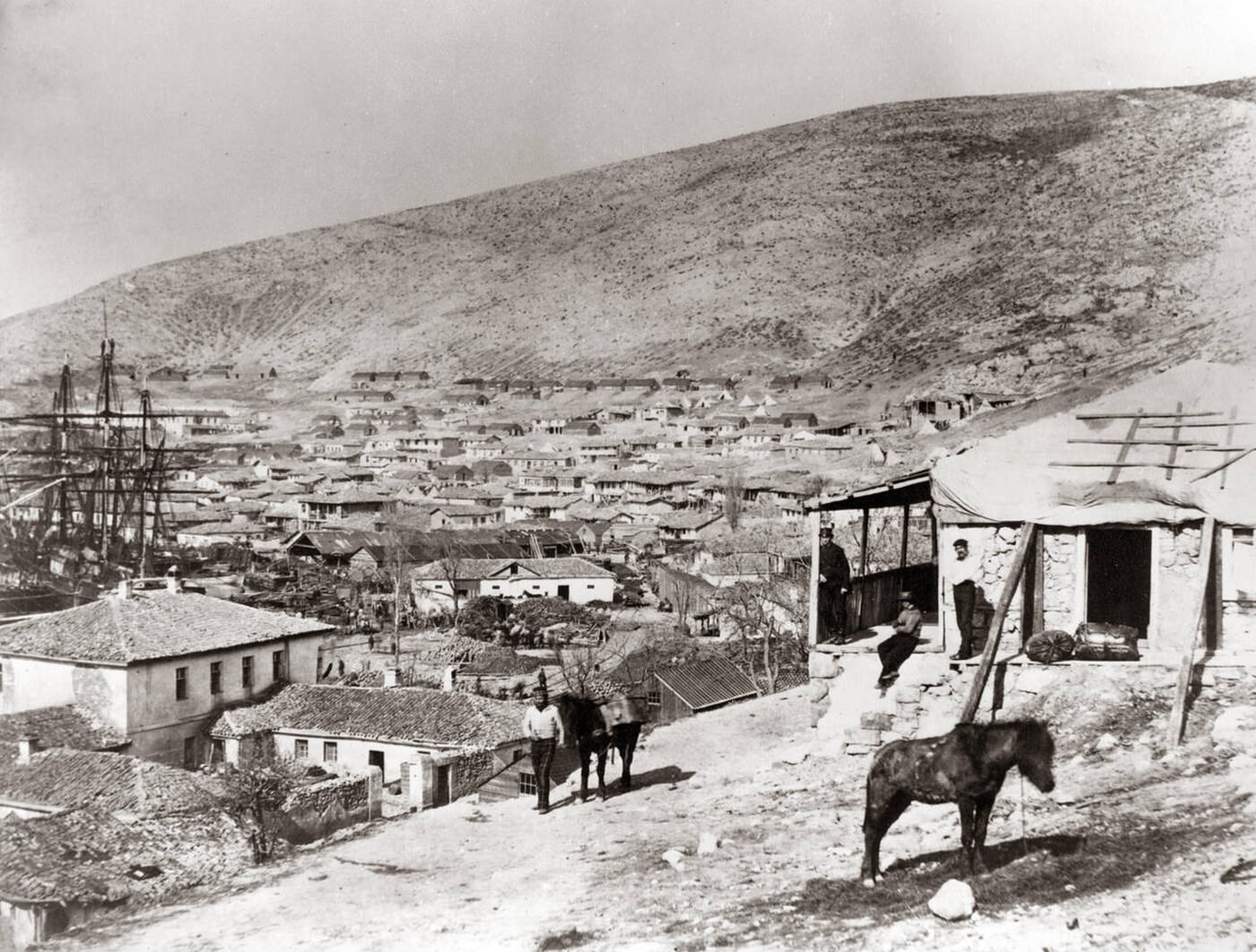
Balaclava spreads across a dry hillside in the 1850s, its tightly packed roofs stepping down toward the harbor where a forest of ship masts rises at the waterline. The town’s low buildings and narrow lanes feel compressed by the surrounding slopes, a reminder that geography shaped daily life as much as any army’s plans. In the distance, the bare ridge dominates the skyline, giving the scene a stark, almost windswept permanence.
In the foreground, a small stone dwelling with a rough porch anchors the view, while a few figures linger at the doorway and along the path below. A horse stands patiently on the incline, and another is led beside a man on the road, details that pull the Crimean War era down from grand narratives to the slow rhythms of transport and labor. The scattered trees and uneven ground hint at a landscape worked hard and lived in, even as the war drew supply lines and soldiers into the same streets.
Seen today, this historical photograph offers more than a panoramic townscape—it’s a study of Balaclava as a wartime port and community, where civilian spaces and military logistics overlapped. The ships in the harbor suggest constant movement: provisions arriving, messages departing, and the sea acting as both lifeline and frontier. For readers interested in the Crimean War, military history, or 19th-century life in the Black Sea region, the image preserves an unusually intimate sense of place.