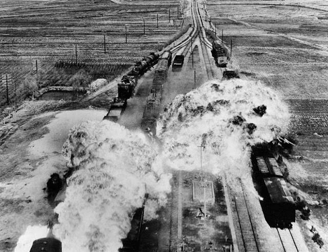
From a high, unforgiving vantage point, the rail lines south of Wonsan become the central artery of a battlefield, split by roads, telegraph poles, and open fields that offer little cover. A train sits on the tracks as bright blast clouds bloom across the right-of-way, turning the neat geometry of transportation into a chaotic scene of smoke and shattered ballast. The stark contrast of the photograph underscores how quickly a working rail corridor could be transformed into a target zone during the Korean War era.
Railroads on North Korea’s eastern coast were more than scenery; they were supply routes, evacuation paths, and symbols of mobility that air power sought to deny. The U.S. Air Force campaign against rail infrastructure focused on disrupting logistics—locomotives, rolling stock, junctions, and the lines themselves—forcing repairs, rerouting, and delays that rippled far beyond the immediate cratered track. In this frame, the concentration of explosions near the train hints at the strategic logic of interdicting movement rather than merely striking terrain.
As a historical photo, it invites readers to look past the dramatic plumes and notice the quieter details: the parallel rails, the scattered vehicles, and the long perspective that makes the corridor seem endless. The scene speaks to the broader story of Cold War conflict in Korea, where air strikes and transportation networks were tightly intertwined, and where “civil wars” and international intervention blurred into one another in the lived experience of infrastructure under attack. For those researching U.S. Air Force operations, Korean War aerial photography, or the history of rail warfare, this image offers a stark, immediate entry point.