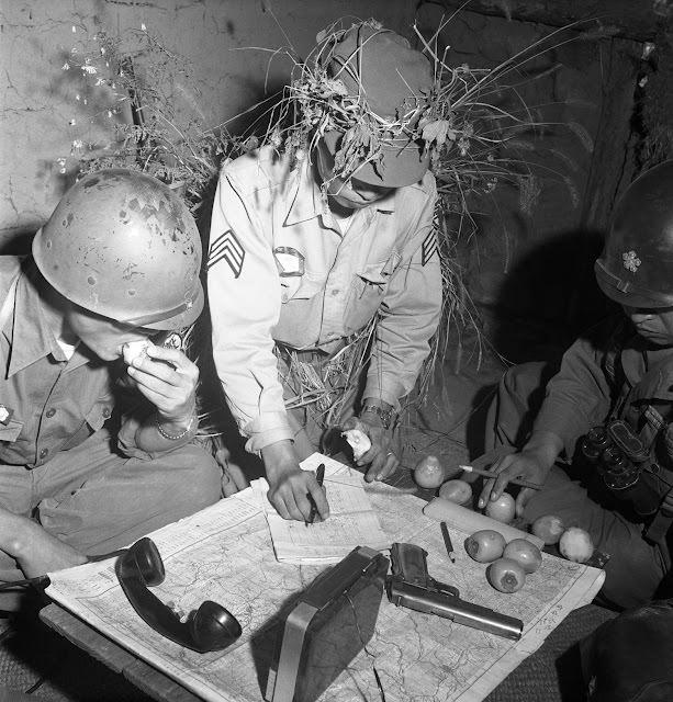
Helmeted officers crowd around a large paper map in a cramped, dimly lit dugout, their sleeves rolled down and their attention fixed on the terrain spread across the table. One man traces a line with his finger while another leans in, studying the markings as if every contour could change what happens next. The post title points to 1952, and the photo’s intimate composition conveys the pressure of wartime planning at close quarters during the Korean War.
Details on the tabletop add to the scene’s immediacy: a field telephone handset lies within reach, a pistol rests near the map’s edge, and a scatter of small round fruits or rations sits beside writing tools and notes. Camouflage foliage tucked into helmets hints at the ever-present risk outside, even while decisions are made indoors. It’s the kind of command moment that rarely makes headlines but shapes operations through quiet calculation and constant communication.
Framed under the theme of “Civil Wars,” the photograph also speaks to coalition command and the shared labor of interpreting landscapes, routes, and enemy positions together. For readers searching for Korean War history, military planning, or South Korean and American cooperation, this image offers a vivid, grounded look at how strategy was hammered out far from the map-room ideal. The tension between ordinary objects and extraordinary stakes is what gives the scene its lasting power.