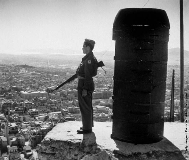
High above Athens on Mount Likebetos, a lone sentry stands rigid at the edge of a rocky outcrop, rifle at his side and eyes fixed on the city spread beneath him. Dense blocks of rooftops and streets fill the basin, fading into hazy hills in the distance, while a rough protective structure beside him hints at the improvised nature of wartime lookout posts. The composition turns the skyline into a battlefield map, measured in sightlines and shadows rather than landmarks.
Set in 1947, the scene belongs to the tense years of the Greek Civil War, when military forces were employed to guard the capital against the threat of communist paratrooper guerrillas. From this vantage point, the guard’s stillness contrasts with the vulnerability of the urban sprawl below—every open square and avenue rendered visible, yet impossible to fully secure. The photograph communicates the era’s uneasy vigilance: an armed presence positioned not for ceremony, but for rapid response and deterrence.
For readers searching Greek Civil War history, Athens wartime photography, or Mount Lycabettus (Likebetos) viewpoints, this image offers a stark reminder of how politics and conflict reshaped everyday geography. It frames the city as something to be watched over, not simply lived in, and captures the way fear of sudden attack could elevate a hilltop into a strategic frontier. Even without naming individuals, the guard’s solitary posture embodies the uncertainty of a nation trying to hold itself together.